|
A WIND ADVISORY IS IN EFFECT UNTIL 10:00 PM THIS EVENING for Southeast Louisiana.
South winds from 25 to 35 mph with higher gusts are expected. Gusty winds could blow around unsecured objects. Tree limbs could be blown down and a few power outages may result. Click HERE to view the official alert. 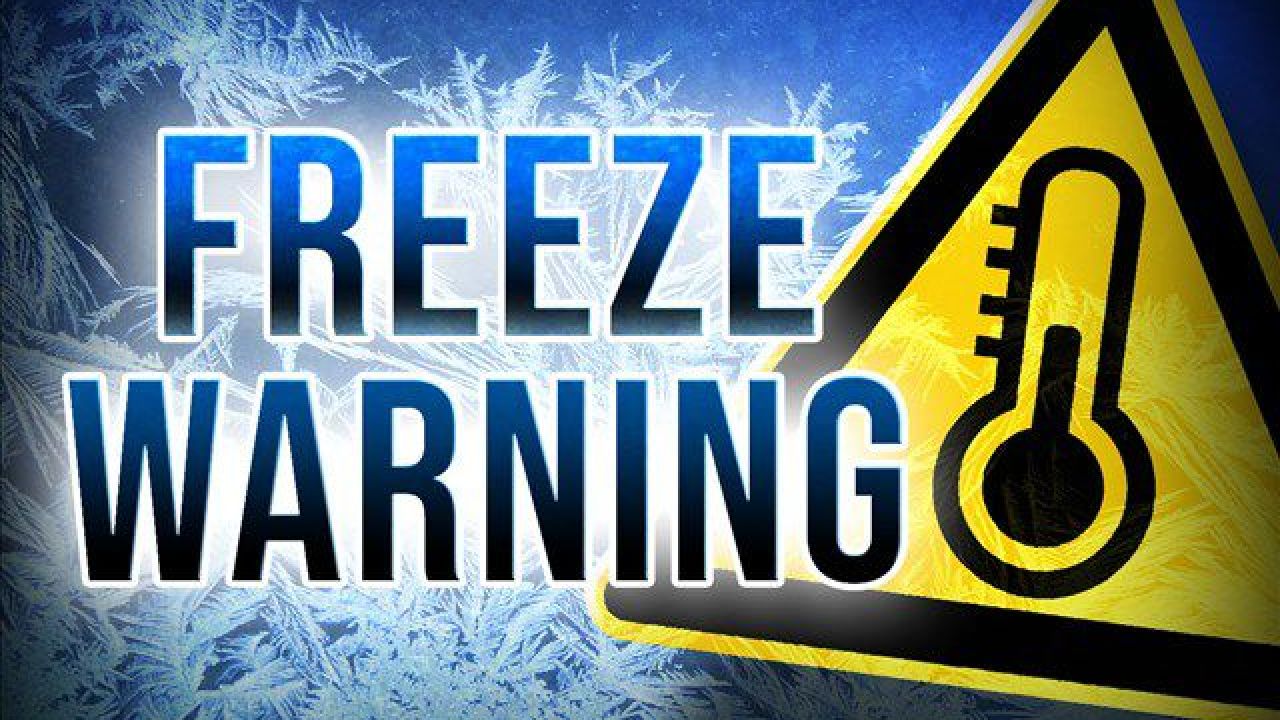 A FREEZE WARNING is in effect for Southeast Louisiana — including the Choctaw, Chackbay, and Bayou Boeuf communities — until 8:00 AM Wednesday morning.
Frost and freeze conditions will kill crops, other sensitive vegetation and possibly damage unprotected outdoor plumbing. Take steps now to protect tender plants from the cold. To prevent freezing and possible bursting of outdoor water pipes they should be wrapped, drained, or allowed to drip slowly.Those that have in-ground sprinkler systems should drain them and cover above- ground pipes to protect them from freezing. Click HERE to view the official alert. Click HERE to view our winter weather preparedness page.  Icy road conditions are possible tonight and on Tuesday. Lafourche Parish is also under a MANDATORY CURFEW from 8:00 PM tonight through 8:00 AM tomorrow.
With that said, we strongly urge everyone to stay home and off the roads if at all possible today and tomorrow, especially during the hard freeze period which is projected for 6:00 PM tonight through noon on Tuesday. For those who MUST drive due to work or otherwise, allow yourself an extra 30 minutes or more to arrive at your destination. If roads are icy, SLOW DOWN and follow these safety tips. Bridges tend to be affected by icy conditions more quickly than roads. We know this could be impossible for some, but try to avoid bridges when driving or limit your route to crossing as few as possible. Check for road closures around the state at 511LA. If there are any major road closures in our area, we'll relay them to you on through text message alerts and on our CURRENT ALERTS page.. We're still here and we'll be working to keep everyone safe. For you. For us. Better. Together. Per Lafourche Parish Government, a mandatory CURFEW is in place for Lafourche Parish from 8:00 PM tonight until 8:00 AM Tuesday due to hazardous conditions expected. 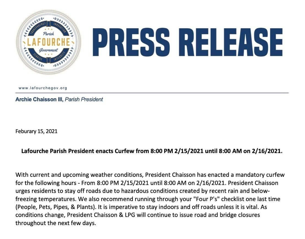 A hard-freeze warning remains in effect from Monday evening through Tuesday morning.
Sub-freezing temperatures in the teens and lower 20’s should be expected. Frost and freeze conditions could kill crops, other sensitive vegetation and possibly damage unprotected outdoor plumbing. A shallow, very cold airmass is currently over much of south Mississippi and southeast Louisiana. An upper level disturbance will bring abundant moisture into the area late tonight and Monday. Temperatures aloft are warm, and precipitation that develops tonight will be rain aloft, but as it reaches the cold air near the surface, it will transition to freezing rain or possibly sleet. Heavy freezing rain or sleet is expected across the warning area during the day Monday before ending from west to east toward sunset. The expected precipitation amounts, especially of ice, are likely to produce significant impacts. After the precipitation ends, even colder air will arrive Monday night, producing wind chill values in the single digits and teens overnight Monday night and Tuesday morning. Click HERE to view our post concerning the Governor’s declaration of a State of Emergency.  Governor John Bel Edwards has declared a STATE OF EMERGENCY due to the current heavy rainfall totals beginning to impact the state and the potential for wintry conditions beginning this weekend and extending to next week.
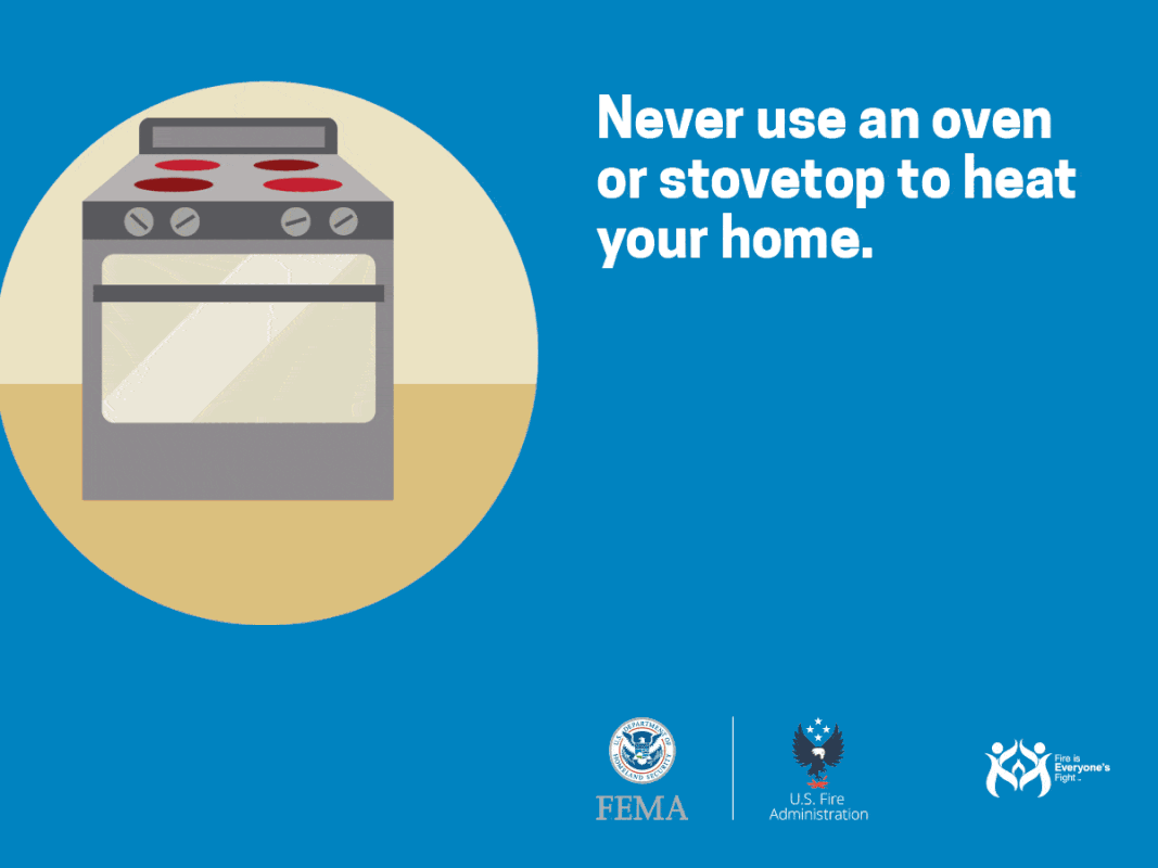
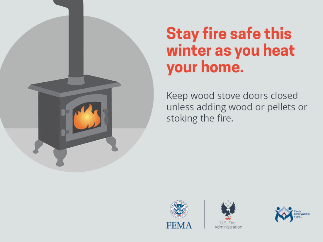
While the forecast beyond the weekend is still uncertain, the Governor’s Office of Homeland Security and Emergency Preparedness (GOHSEP) is urging all Louisianans to plan accordingly. Flash flooding from heavy rains can happen very quickly. While flooded roadways and flash flooding are the immediate concerns, there is the potential for additional weather issues beginning tomorrow. The National Weather Service (NWS) indicates an Arctic high pressure system is pushing south, bringing with it the coldest air of the season to at least portions of the state. “Already in Louisiana we have communities that have seen the impacts of flash flooding and water on the roadways, and there is the potential for worse weather and bad conditions as the days go on. Now is the time for people to make a plan for the coming days that could include staying at home during severe weather,” Governor Edwards said. ”Monitor the local news and updates from the National Weather Service and your local leaders, check on your neighbors and stay safe.” “The conditions over the next few days include a number of threats,” said GOHSEP Director Jim Waskom. “Right now we know heavy rain is forcing street closures in some regions and a flash flood threat will continue. We also know that dangerous winter weather conditions are in the forecast for Louisiana through the middle of next week. That means we all must remain aware of the severe weather threat, finalize your emergency plans for the winter weather threat and be ready to adjust those plans due any changes in the forecast or due to potential weather alerts being issued.” Community sites for COVID testing managed by Louisiana’s National Guard will close on Monday and Tuesday. Remember to take steps to prepare for the freezing temperatures. For pets and animals, bring them inside wherever possible and make sure drinking water stays unfrozen. For your home, protect your pipes and safely operate heating devices. Check on friends, neighbors or family members that may struggle with these weather conditions. If travel is in your plans, visit 511LA for updates on road conditions. GOHSEP is closely monitoring this weather threat and stands ready to support our local partners and state agencies if help if needed. Visit our winter weather preparedness page by clicking HERE. The National Weather Service in New Orleans has issued a Flood Advisory for Northwestern Lafourche Parish in southeastern Louisiana -- including Thibodaux, Choctaw, Chackbay and Bayou Boeuf -- until 2:45 PM.
At 11:35 AM CST, Doppler radar indicated heavy rain due to thunderstorms. Minor flooding is ongoing or expected to begin shortly in the advisory area. Between 1 and 2 inches of rain have fallen Additional rainfall of 1 to 3 inches is expected over the area. This additional rain will result in minor flooding.
At 10:20 AM, radar indicated strong thunderstorms were located along a line extending from Whitehall , Louisiana, to near Supreme, Louisiana.
Movement was northeast at 60 mph. Winds in excess of 40 mph are possible with these storms. The North Lafourche area -- Thibodaux, Choctaw, Chackbay, and Bayou Boeuf -- may be impacted. Torrential rainfall is also occurring with these storms, and may cause localized flooding. Do not drive your vehicle through flooded roadways. Sharing from the Louisiana State Police. State Police are cautioning drivers to be careful as cold weather moves through the area over the weekend. The National Weather Service is monitoring a cold front that could create a mixture of rain and snow in south Louisiana late Sunday into early Monday, officials said. The weather could affect roadway surfaces and create dangerous driving conditions, State Police said. Road closures are possible and expected across the state. ”Before deciding whether travel is necessary, Louisiana State Police urges motorists to stay informed with the latest weather and travel conditions,” State Police said in a release. ”Freezing rain and sleet can cause bridges and overpasses to ice quickly, as temperatures near the freezing point. If conditions deteriorate, motorists are encouraged to refrain from driving until conditions improve. If ice accumulates on bridges and/or overpasses, LSP will work closely with the Louisiana Department of Transportation and Development and our local law enforcement partners to take appropriate measures.” Call 511 for road closure information or visit the 511LA by clicking HERE. You can also download the Louisiana 511 mobile application. State Police are offering the following winter weather driving tips:
DOWNLOAD THE |


Choctaw Volunteer Fire Department
2854 Choctaw Road
Thibodaux, Louisiana 70301
Phone: (985) 633-2888
2854 Choctaw Road
Thibodaux, Louisiana 70301
Phone: (985) 633-2888
Copyright 2024
Emergency Alerts Provided By WillyWeather
Payments Processed By Square
Privacy Policy | Terms Of Use | Area Amenities
HIPAA BAA | System Status
Emergency Alerts Provided By WillyWeather
Payments Processed By Square
Privacy Policy | Terms Of Use | Area Amenities
HIPAA BAA | System Status